Deadman Vidette Rd.
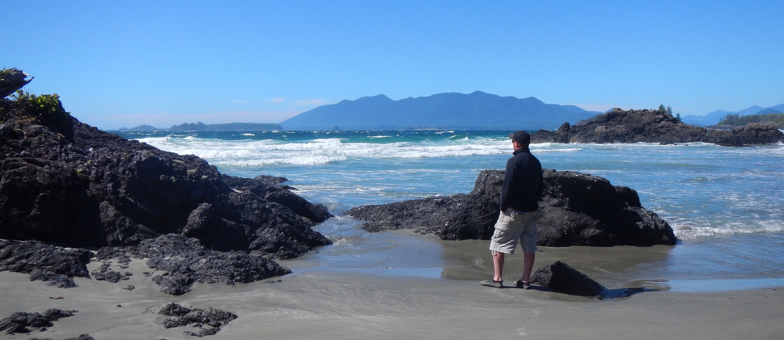
I haven’t spent much time in the interior of British Columbia but I was pleasantly reminded of the beautiful and various landscapes that our province has to offer. It truly is unsurpassed and there’s something for everyone. I spent two nights camping at the Brookside Campground just outside of Cache Creek and a full day exploring Deadman Vidette Rd. In between Cache Creek and Savona, travelling east on Highway 1 Deadman Vidette Rd. heads north for approximately 70 km’s.

The scenery and the area is as majestic as it is peculiar and eerie. First Nations have held the area sacred for thousands of years and more recently in 1980 high ranking Tibetan Monks claim an area near Vidette Lake to be the center of the universe.
http://www.tourismkamloops.com/centre-of-the-universe-in-kamloops-british-columbia
Waterfalls

Deadman falls is located not far from Vidette Lake and the center of the universe. Viewing the falls is not for the faint at heart or for those that don’t like heights. The falls plunge far below some 150-200 feet into a deep canyon. A wrong step would be your last. The ground surrounding the outer edges is undermined making it very deceiving. I didn’t stay long knowing that challenging myself to find a good vantage point for photography could be fatal. Typically I don’t let this notion deter me but for reasons unknown I was fearful. Perhaps the forces at the center of the universe were with me on this day.
Old Trucks
All along the Deadman Vidette Rd. remnants of times past can be seen. I’m a nature photographer but I appreciate the juxtaposition between nature and humanity from time to time and I certainly wouldn’t pass up an opportunity to photograph old trucks long forgotten about in a field. It was an opportunity also to further explore daytime long exposure photography with my B+W 10 stop ND filters. The images below were taken between 15-30 seconds at high noon.


Wildlife
Deadman Vidette Rd. is not without wildlife. There’s deer everywhere, coyotes, prairie dogs and black bears. After spending an hour or more photographing the old trucks much to my surprise a female black bear ran out in front of me while I was driving along. I watched her climb up into a wooded area before losing sight of her. I immediately pulled over, put my telephoto lens on and quietly walked up into the woods where she had went. It was at this point that I realized that she was in fact female when I startled her and the three cubs that she was protecting. She bluff charged a few meters towards me, huffing and puffing. I backed off and she proceeded to climb up the tree where her three cubs were. It was a humbling experience to say the least but rewarding as well. I didn’t stay long so as not to disturb her or the cubs.


Links
Click on the links below for more great blogs, pictures and reading about Deadman Vidette Rd.
http://www.wheretogoandhowtogetthere.com/deadman-falls.html
Ahh..I know that area pretty well. I even rented a cabin at the lodge for a few days. Gosh, I am just up the road a piece in Kamloops, so it ain’t far for me. I began shying away from those falls when sink holes started appearing.
I am glad you discovered how interesting and active the road to and past the falls is. Thats where I also point my camera. Great images and I, as always, enjoyed your commentary.
I was thinking you’d enjoy this post. There’s something mysterious about that road and surrounding area. I can’t quite put my finger on it. I’ve been around a lot of waterfalls and have taken chances getting to vantage points but not Deadman falls. Honestly it’s only the second waterfall that I’ve been to that actually scared me. I left almost as soon as I arrived.
Ahh…I knew you were a smart guy. Next time you are in my area we should have coffee.
I agree 100% John! Let’s make a point on doing that and the other way around too if you happen to be over this way. I’d like to tap your brain on some of your experiences and what not and doing so face to face I feel is always the best way.
Even though and again this is odd for me but5 I was consumed by fear at those falls I was however curious if there’s a way to get to the other side or better yet down along the canyon bottom in order to get a better vantage point? There doesn’t seem to be a whole lot of information available on that or even images that depict someone doing so.
I’ve walked along both sides of the falls. You can easily cross the river at the bridge above the falls, but ya can’t get down.
I have often thought the trek “up” the river to the base of the falls. I think one must catch the river and hike along the flatlands…the road runs along the river in places. I don’t every remember pictures from the base. And I have visited that place (spring, summer, fall and winter) since the late 1970’s – when it was a lot SAFER. sorry, I had to use caps for effect…
I didn’t know there was a bridge above the falls. The river was running hard (snow melt I presume) and there was a lot of flooding. I tried to drive past the turn off to the falls but the road was pretty washed out and I didn’t want to get stuck. There must be a way to hike to the base of the falls and follow the river like you suggest. Has anyone ever fallen over / been killed at the falls?
Fall is the best time to be there. the river is lower and the colours are better. The road returns to the main highway after winding thru the high hills.
I never heard of anyone falling. I used to lead scenic photo workshops – and those falls were one of the sites.
Why I stopped?
1. There was a large deadfall across the river about 10 feet back from the falls. I returned to see a student crawling across! I don’t have the space to explain what went thru my mind at that moment. She survived and took lots of pictures from the other side and we found a safer place down river for her to return.
2. A sink hole widened and dirt fell thru while we were setting up our tripods.
I stopped trips to that location..
Have you visited Wells Grey Park yet?
Hi I would like to chime in, would you know the native legend of the Hoodoos at KM16 ?
My connection to them goes back forty years. Last summer i went up close again
and took some pictures.
The road from vidette over criss creek to tranquille is interesting to.
cheers
Hans
I do not know of this legend Hans, it sounds very interesting though. Perhaps I read about it but it left me but it doesn’t ring a bell unfortunately. Thank you for sharing.
I don’t know about that legend either Hans. I have photographed those hoodoos from the road and crossed the fence to get more interesting closeups.
I can’t remember if I have taken that Criss creek route – I need to check a map.
Wow! Imagine!! Some people have a very high tolerance of risk! I don’t blame you for not wanting to lead workshops there anymore. There’s way too much liability regardless of any release statements, there’s the moral liability. I’ve seen pictures of people standing right by the edge of the river when the water was really low. It horrifies me.
I haven’t been up to Wells Grey yet but it’s definitely on my list.
Nice pictures/framing Martin.
Oddly, I recently drove Highway #1’s route east from Cache Creek to Kamloops for the first time in 40 years, and remain so impressed with the Deadman Vidette canyon and landscape that I Googled it today and found your site. If something can stay with you after just viewing a fraction of it from a moving car, it’s well worth revisiting. Thanks for the photos, cautions, and informative comments from other
Hi Elsie, it is a remarkable area! I’m glad my post was of assistance.